Nearest Town
Chamonix
Altitude
1650m
Capacity
Accommodation
Phone
PhoneNumber
Website
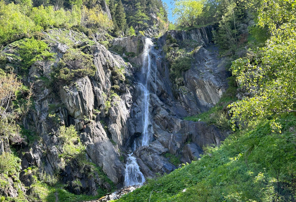
The Cascade du Chapeau is a waterfall located right next to the Le Chapeau Buvette at the foot of the Mer de Glace glacier. The water from the waterfall comes from the Torrent du Chapeau which meets the Arveyron river near the Source de l'Arveyron a bit lower down in the valley at the mouth of the Arveyron river where it is formed below the Mer de Glace river. We got a nice trail nearby for a visit to the Source de l'Arveyron which is located lower down closer to the valley floor.
You pass the Cascade du Chapeau on your way to the Chapeau snack bar. We got wonderful, family friendly trail that starts in the hamlet of Le Lavancher and visits the cascade, the buvette and moves on to the nearby view point for the Mer de Glace.
There are warning signs around the waterfall not to stay in that area or approach the waterfall. There is frequent rockfall in the area and as such you should not get of the trail and aim to approach the waterfall for a closer look. From the Chapeau snack bar you can have a bit of a closer look but much of the waterfall is covered by rock from that angle.
Cascade du Chapeau Photos
Below are all the photos we have in our Chamonix Photos collection for this point of interest. All our photos are tagged with the GPS coordinates and linked to the trails that you can take to find the location where the photo was taken. So if you want to see the full details for a specific photo then just click on it.
Hiking & Running Trails to Cascade du Chapeau
All the trails and points of interest around Chamonix on our website are linked to each other so you can easily pick trails that cover the things you would like to see or visit sights that are nearby and can easily be combined with your target destination. These are the hiking and trail running trails and points of interest linked to Cascade du Chapeau
Length
2.89km
Elevation +
+303m / -303m
Difficulty
Very Easy
9
Exceptional
Dogs
Dogs Allowed
Children
4+ Years old
When to Go
End Apr - Mid Oct
A short but very worthwhile little trail with nice views of the Rochers des Mottets. The trail ends at the Le Chapeau Buvette where you can enjoy a variety of snacks and drinks
Points of Interests near Cascade du Chapeau
Where is Cascade du Chapeau?
Longitude:
6.9169
Latitude:
45.949
Below you will find the location of Cascade du Chapeau on the map. You can also click the button to show the nearby trails and points of interests that are listed above on the same map. Another option is to visit our interactive map that shows Cascade du Chapeau and everything else that is listed on our website.
Looking for more Waterfalls?
Cascade du Chapeau is only one of many waterfalls around Chamonix. We got many more we would love to show you and many more you should visit! To view all the other waterfalls we cover on our website, you can visit our Waterfalls around Chamonix page or view all the waterfalls around Chamonix on our interactive map
Looking for other sights, attractions and points of interest around Chamonix?


