Nearest Town
Chamonix
Altitude
2461m
Capacity
Mountain Pass
Accommodation
Phone
PhoneNumber
Website
The Col de la Gliere is a mountain pass at an altitude of 2461m, high above the grand balcon sud between the Flegere and Planpraz lifts. There are 3 mountain lakes nearby: the two Lacs Noir and Lac Cornu. A short traverse brings you over to the nearby Col Cornu.
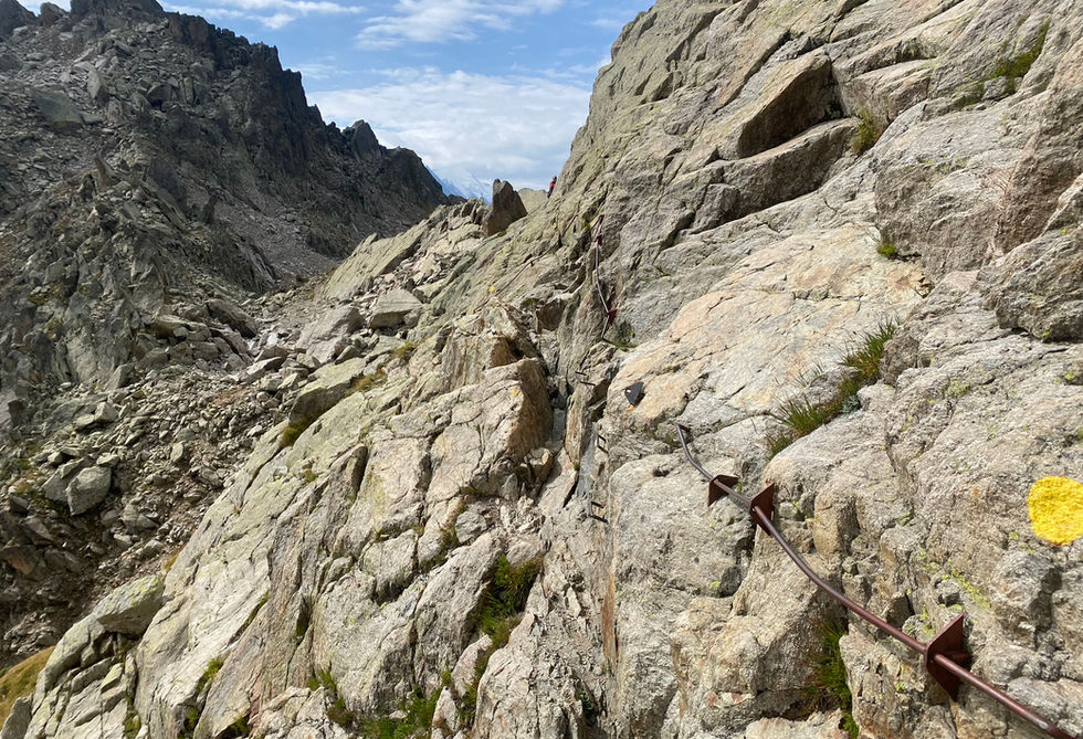
The Col de la Gliere has one main trail running through it taking you from Col Cornu to the Index lift station. The trail contains some metal hand supports on the last bit which is rocky and quite steep. The col gives great views towards the Mont Blanc Massif on one side and distant views towards the Chaine des Aravis beyond Sallanches. In winter the Col de la Gliere is part of a popular ski touring route going from the Cornu lift towards Col de Lac Cornu, Col de la Gliere and then skiing down towards Flegere.
Col de la Gliere Photos
Below are all the photos we have in our Chamonix Photos collection for this point of interest. All our photos are tagged with the GPS coordinates and linked to the trails that you can take to find the location where the photo was taken. So if you want to see the full details for a specific photo then just click on it.
Hiking & Running Trails to Col de la Gliere
All the trails and points of interest around Chamonix on our website are linked to each other so you can easily pick trails that cover the things you would like to see or visit sights that are nearby and can easily be combined with your target destination. These are the hiking and trail running trails and points of interest linked to Col de la Gliere
Length
16.45km
Elevation +
+1552m / -1011m
Difficulty
Very Difficult
9
Exceptional
Dogs
No Dogs
Children
15+ Years old
When to Go
End Jun - End Sep
A tough but beautiful trail that takes you from the Col des Montets upto Lac Blanc and from there you traverse the Aiguilles Rouges and visit Lacs Noirs and Lac Cornu
Points of Interests near Col de la Gliere
Where is Col de la Gliere?
Longitude:
6.856668
Latitude:
45.96058
Below you will find the location of Col de la Gliere on the map. You can also click the button to show the nearby trails and points of interests that are listed above on the same map. Another option is to visit our interactive map that shows Col de la Gliere and everything else that is listed on our website.
Looking for more Summits and Mountain Passes?
Col de la Gliere is only one of many summits and mountain passes around Chamonix. We got many more we would love to show you and many more you should visit! To view all the other summits and mountain passes we cover on our website, you can visit our Summits and Mountain Passes around Chamonix page or view all the summits and mountain passes around Chamonix on our interactive map
Looking for other sights, attractions and points of interest around Chamonix?


