Nearest Town
Les Contamines
Altitude
1200m
Capacity
Cross
Accommodation
Phone
PhoneNumber
Website
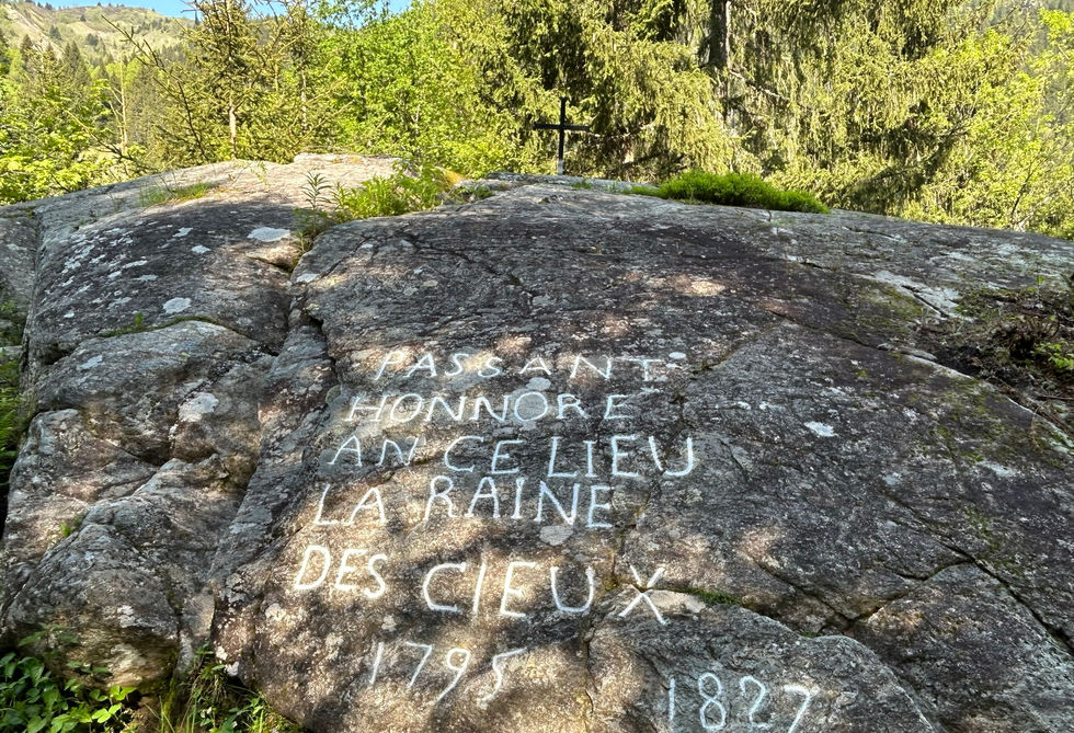
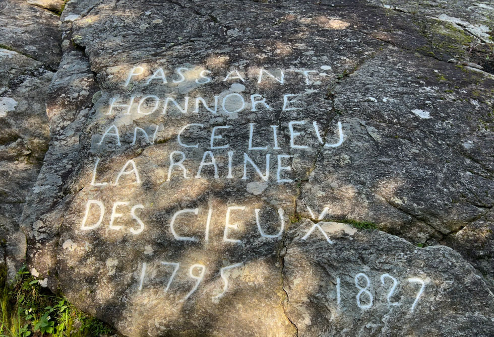
This little black metal cross has been mounted on a big rock along the initial ascend of the Voie Romain across from the Notre Dame de la Gorge at the southern end of the Montjoie Valley. The Sainte Chapel lies directly below it.
The text on the rock has been lovingly restored in 2017 by volunteers of the Les Contamines heritage organisation. You can learn more their restoration work of the text on their website. The text reads: "passante honnore an ce lieu la raine des cieux ". Translate in English "While passing by, honour the rains from the heavens". We found a source that says that a local woodcutter made the inscription in the rock after falling in that location and the rains that year had made the river below high enough that he survived the fall. We could not find the meaning of the year 1795 – 1827.
We got a detailed trail description on our website for our Notre Dame de la Gorge discovery tour which visits all main points of interests around the Notre Dame including this cross and the nearby waterfalls at Pont Romain and Combe Noir and the Refuge de Nant Borrant.
Cross at the Voie Romain Photos
Below are all the photos we have in our Chamonix Photos collection for this point of interest. All our photos are tagged with the GPS coordinates and linked to the trails that you can take to find the location where the photo was taken. So if you want to see the full details for a specific photo then just click on it.
Hiking & Running Trails to Cross at the Voie Romain
All the trails and points of interest around Chamonix on our website are linked to each other so you can easily pick trails that cover the things you would like to see or visit sights that are nearby and can easily be combined with your target destination. These are the hiking and trail running trails and points of interest linked to Cross at the Voie Romain
Length
8.9km
Elevation +
+493m / -493m
Difficulty
Moderate
9
Exceptional
Dogs
Dogs Allowed
Children
7+ Years old
When to Go
Start May - Mid Oct
Absolutely beautiful trail with a gorgeous church and a couple of really nice waterfalls in beautiful forests and open fields. Great variety in absolutely amazing scenery.
Points of Interests near Cross at the Voie Romain
Where is Cross at the Voie Romain?
Longitude:
6.71386389
Latitude:
45.78820556
Below you will find the location of Cross at the Voie Romain on the map. You can also click the button to show the nearby trails and points of interests that are listed above on the same map. Another option is to visit our interactive map that shows Cross at the Voie Romain and everything else that is listed on our website.
Looking for more Oratories and Crosses?
Cross at the Voie Romain is only one of many oratories and crosses around Chamonix. We got many more we would love to show you and many more you should visit! To view all the other oratories and crosses we cover on our website, you can visit our Oratories and Crosses around Chamonix page or view all the oratories and crosses around Chamonix on our interactive map
Looking for other sights, attractions and points of interest around Chamonix?


