top of page
List of of all lakes around Chamonix

Lac Noir

7

Our Rating

Good

BluePOI-Town.png

Nearest Town

Les Houches

BlueTrail-Verticals.png

Altitude

1546m

BluePOI-Capacity.png

Capacity

BluePOI-Accommodation.png

Accommodation

BluePOI-Telephone.png

Phone

PhoneNumber

BluePOI-Website.png

Website

Visit Website

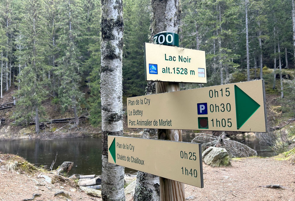
The Lac Noir is a small lake located above Les Houches at an altitude of 1546 meters. The lake can be reached using a trail that runs between Parc Merlet and the hamlet of Le Coupeau. There are trail markers on the nearby trails that you can follow to easily reach the lake. The Christ Roi statue is a popular nearby attraction.


The lake is black as name suggests and not very large in size. Its southern bank has a nice elevated position with some rocks that could make for a nice picnic spot.

Lac Noir Photos

Below are all the photos we have in our Chamonix Photos collection for this point of interest. All our photos are tagged with the GPS coordinates and linked to the trails that you can take to find the location where the photo was taken. So if  you want to see the full details for a specific photo then just click on it.

Hiking & Running Trails to Lac Noir

All the trails and points of interest around Chamonix on our website are linked to each other so you can easily pick trails that cover the things you would like to see or visit sights that are nearby and can easily be combined with your target destination. These are the hiking and trail running trails and points of interest linked to Lac Noir

Merlet to Plan de la Cry and Le Christ Roi

Length

5.67km

Elevation +

+376m / -376m

Difficulty

Easy

5

Average

Dogs

Dogs Allowed

Children

4+ Years old

When to Go

Mid Apr - End Oct

This little loop takes you from the Merlet parking lot to a nice traverse to the Plan de la Cry, through the village of Coupeau to the Christ Roi statue

Points of Interests near Lac Noir

Le Christ Roi

Statue

9

Exceptional

Large 25 meter tall Statue of Christ the King above Les Houches

Nearest Town

Les Houches

Altitude

1180m

View on Map
Aiguilette des Houches

Mountain Ridge

10

The Best

Crest Summit on the edge of the Carlaveryon nature reserve above Les Houches

Nearest Town

Les Houches

Altitude

2285m

View on Map
Les Houches

Town

8

Very Good

Larger town on the western side of the Chamonix Valley

Nearest Town

Les Houches

Altitude

1007m

View on Map

Where is Lac Noir?

Longitude:

6.80048

Latitude:

45.90847

​Below you will find the location of Lac Noir on the map. You can also click the button to show the nearby trails and points of interests that are listed above on the same map. Another option is to visit our interactive map that shows Lac Noir and everything else that is listed on our website.

Show nearby Trails & Points of Interest

Looking for more Lakes?

Lac Noir is only one of many lakes around Chamonix. We got many more we would love to show you and many more you should visit! To view all the other lakes we cover on our website, you can visit our Lakes around Chamonix page or view all the lakes around Chamonix on our interactive map

Looking for other sights, attractions and points of interest around Chamonix? 

Summits & Cols

Summits and Mountain Passes offering amazing views

Refuges

Refuges offer mountain accommodation, often at altitude

Churches & Chapels

Beautiful Churches & Chapels with incredible histories

Waterfalls

Beautiful Waterfalls, or Cascades, as they are called in French

Mountain Restaurants

Snack Bars and Mountain Restaurants serving Food and Drinks

Oratories & Crosses

Small Religious Sites often placed on cross roads

Glaciers

Glaciers are some of the most iconic natural features of Chamonix

Towns & Hamlets

Lovely Towns, Villages and Hamlets around Chamonix

The content on this page has been made with the help of the following contributors:

bottom of page