Nearest Town
Chamonix
Altitude
1082m
Capacity
Hamlet
Accommodation
Phone
PhoneNumber
Website
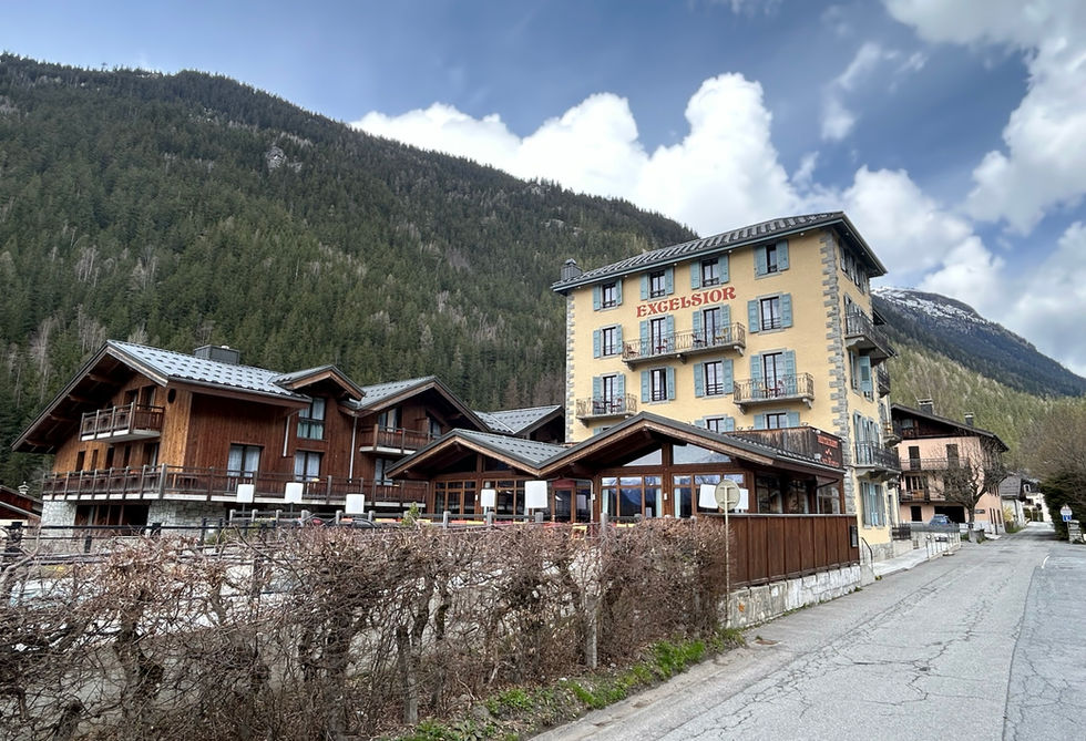
Les Tines is a small hamlet located between Chamonix and Argentiere stretching from the Chamonix Golf course to end of the lower part of the Chamonix Valley. Les Tines is mostly a residential area and has no real commercial center or any shops. There are two hotels: The Residence Odalys Isatis along the main road going up the valley and the Excelsior Hotel, Restaurant & Spa. Les Tines has a very old Chapel with a fascinating history. It is definitely worth a visit. Les Tines has its own train station and a bus stop so getting to Les Tines is quite easy.
Walking to Les Tines from Chamonix takes roughly one hour. You can also visit it as part of the Petite Balcon Sud or the Petit Balcon Nord. Right across the road from Les Tines, is the hamlet of Le Lavancher with one of our favorite trails going to Le Chapeau. The very pretty river Arve runs right next to Les Tines and an easy walk takes you to Paradis des Praz, a very popular playground with snack bar in a very beautiful location.
Les Tines Photos
Below are all the photos we have in our Chamonix Photos collection for this point of interest. All our photos are tagged with the GPS coordinates and linked to the trails that you can take to find the location where the photo was taken. So if you want to see the full details for a specific photo then just click on it.
Hiking & Running Trails to Les Tines
All the trails and points of interest around Chamonix on our website are linked to each other so you can easily pick trails that cover the things you would like to see or visit sights that are nearby and can easily be combined with your target destination. These are the hiking and trail running trails and points of interest linked to Les Tines
Points of Interests near Les Tines
Where is Les Tines?
Longitude:
6.898739585846093
Latitude:
45.950569492735326
Looking for more Towns and Hamlets?
Les Tines is only one of many towns, hamlets and villages around Chamonix. We got many more we would love to show you and many more you should visit! To view all the other towns, hamlets and villages we cover on our website, you can visit our Towns and Hamlets around Chamonix page or view all the villages and towns around Chamonix on our interactive map
Looking for other sights, attractions and points of interest around Chamonix?


