top of page
List of of all Towns and Hamlets around Chamonix

Montroc

7

Our Rating

Good

BluePOI-Town.png

Nearest Town

Le Tour

BlueTrail-Verticals.png

Altitude

1368m

BluePOI-Capacity.png

Capacity

Hamlet

BluePOI-Accommodation.png

Accommodation

BluePOI-Telephone.png

Phone

PhoneNumber

BluePOI-Website.png

Website

Visit Website

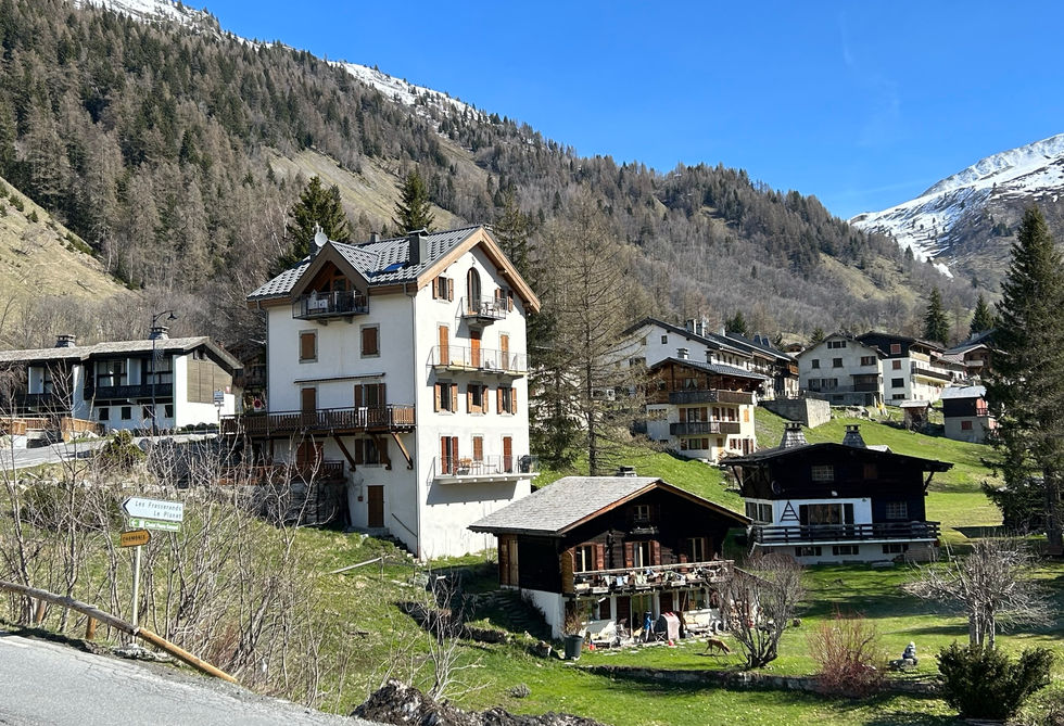
Montroc is a small hamlet at the north western end of the Chamonix Valley on the road up from Argentiere to Le Tour. It is a very small hamlet without any commercial establishments, restaurants or hotels. It is mostly residential and neighbors directly to Les Frasserands. There is a dairy farm called the Ferme de Montroc which sells home-made cheeses and other dairy products. This farm is located on the other side on the river on the trail to Le Planet.


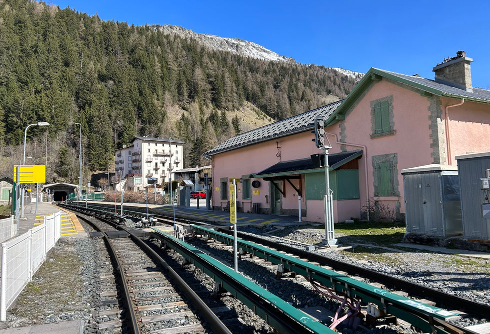
The Montroc-Le-Planet train station serves all the neighboring hamlets of Le Planet, Montroc, Les Frasserands and Tre-le-Champ. The train runs through the entire Chamonix Valley starting at Saint-Gervais-les-Bains and ending at Vallorcine from where the swiss train runs all the way to Martigny in Switzerland. There is also a bus station in Montroc. There is parking located on the side of the road going towards the train station.


Montroc was hit by a large avalance on February 9, 1999 that killed 12 people. There had been an exceptional amount of snow in a short period of time and the avalanche came from the Montagne de Peclerey. The mayor of Chamonix at the time was found guilty of involuntary manslaughter and received a suspended prison sentence of 3 months for failing to evacuate the residents on time. There is a memorial cross remembering the victims of this big avalance at the foot of the Montagne de Peclerey on the main road towards Le Tour.

Montroc Photos

Below are all the photos we have in our Chamonix Photos collection for this point of interest. All our photos are tagged with the GPS coordinates and linked to the trails that you can take to find the location where the photo was taken. So if  you want to see the full details for a specific photo then just click on it.

Hiking & Running Trails to Montroc

All the trails and points of interest around Chamonix on our website are linked to each other so you can easily pick trails that cover the things you would like to see or visit sights that are nearby and can easily be combined with your target destination. These are the hiking and trail running trails and points of interest linked to Montroc

Argentiere Tre-le-Champ Discovery Loop

Length

7.57km

Elevation +

+325m / -325m

Difficulty

Very Easy

7

Good

Dogs

Dogs Allowed

Children

7+ Years old

When to Go

Mid May - End Oct

This is a very nice, family friendly discovery loop exploring the villages of Argentiere, Le Planet, Montroc and Tre-le-Champ and the many points of interest along the way.

Le Tour and Montroc Short Loop

Length

4.56km

Elevation +

+226m / -226m

Difficulty

Easy

8

Very Good

Dogs

Dogs Allowed

Children

4+ Years old

When to Go

End Apr - End Oct

A fantastic family-friendly loop between the hamlets of Le Tour and Montroc with a nice variety of forest, views and charming hamlets

Points of Interests near Montroc

Montroc Avalanche Memorial

Memorial

8

Very Good

Memorial for the 12 victims of the 1999 Montroc Avalanche

Nearest Town

Le Tour

Altitude

1398m

View on Map
Cross at Le Chenavier

Cross

8

Very Good

Wooden cross at a chalet at nice elevated location near Le Tour

Nearest Town

Le Tour

Altitude

1518m

View on Map
Tre-le-Champ

Hamlet

8

Very Good

Beautifully situated hamlet with great views at the north western end of the Chamonix Valley

Nearest Town

Argentiere

Altitude

1402m

View on Map
Le Tour

Hamlet

7

Good

Hamlet at the far north-eastern end of the Chamonix Valley

Nearest Town

Le Tour

Altitude

1468m

View on Map
Le Planet

Hamlet

8

Very Good

Small and very scenic hamlet perched above Argentiere

Nearest Town

Argentiere

Altitude

1392m

View on Map
Auberge la Boerne

Refuge

8

Very Good

Refuge with restaurant in Tre-le-Champ at the north-western end of the Chamonix Valley

Nearest Town

Argentiere

Altitude

1402m

View on Map

Where is Montroc?

Longitude:

6.9348

Latitude:

45.9968

​Below you will find the location of Montroc on the map. You can also click the button to show the nearby trails and points of interests that are listed above on the same map. Another option is to visit our interactive map that shows Montroc and everything else that is listed on our website.

Show nearby Trails & Points of Interest

Looking for more Towns and Hamlets?

Montroc is only one of many towns, hamlets and villages around Chamonix. We got many more we would love to show you and many more you should visit! To view all the other towns, hamlets and villages we cover on our website, you can visit our Towns and Hamlets around Chamonix page or view all the villages and towns around Chamonix on our interactive map

Looking for other sights, attractions and points of interest around Chamonix? 

Summits & Cols

Summits and Mountain Passes offering amazing views

Glaciers

Glaciers are some of the most iconic natural features of Chamonix

Churches & Chapels

Beautiful Churches & Chapels with incredible histories

Lakes

Beautiful Mountain and Valley Lakes definitely worth visiting

Refuges

Refuges offer mountain accommodation, often at altitude

Oratories & Crosses

Small Religious Sites often placed on cross roads

Waterfalls

Beautiful Waterfalls, or Cascades, as they are called in French

Mountain Restaurants

Snack Bars and Mountain Restaurants serving Food and Drinks

The content on this page has been made with the help of the following contributors:

bottom of page