Nearest Town
Les Contamines
Altitude
1217m
Capacity
Chapel
Accommodation
Phone
PhoneNumber
Website
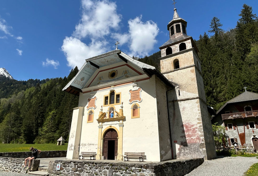
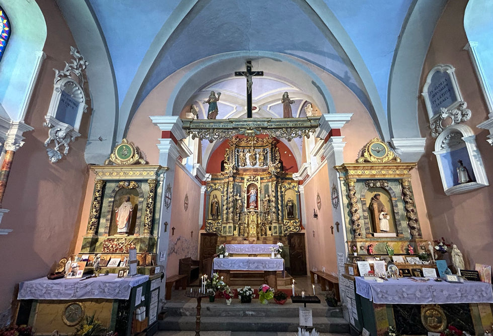
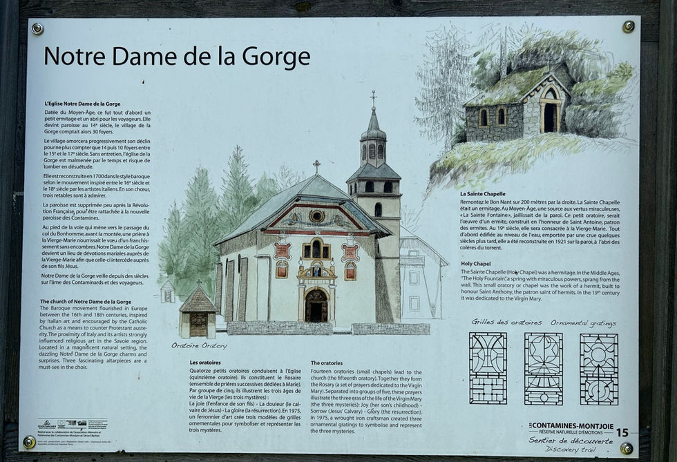
The Notre Dame de la Gorge chapel is one of our favorite chapels in the region. It has an absolutely amazing location at the south end of the Montjoie Valley about 4km south from Les Contamines-Montjoie. It sits at the edge of the forest where many amazing trails start. A big part of the grandeur of the chapel is the beautifull road that leads to the chapel with the 14 small oratories lining the road and surrounding the chapel. In 2015 the chapel was listed as a historical monument and a plaque was placed at the entrance marking it as such. The Notre Dame de la Gorge has a very long history going all the way back to the 10th century when a hermit created a shelter for travelers dedicated to Saint Anthony. This shelter will become a parish. The church was reconstructed from 1699 to 1707 by the parish priest Nicolas Gouttry.
The niche above the main door has a statue of Madonna and Child. The texts on the left and right of the statue state "Who finds Marry find Life" and "She has her foundation in the Holy Mountains". The 14 oratories surrounding the chapel are part of the rosary marking the stages of the life of the Virgin Marry. Together with the chapel they mark the 5 Joyful Mysteries, the 5 Sorrowful Mysteries and the 5 Glorious Mysteries. The oratories were built in 1728 under the guidance of Priest Gaillard. In 1975 the the metal grates where crafted and added to the oratories with 3 designs, 1 for each of the 5 Mystery groupings.
Notre Dame de la Gorge Photos
Below are all the photos we have in our Chamonix Photos collection for this point of interest. All our photos are tagged with the GPS coordinates and linked to the trails that you can take to find the location where the photo was taken. So if you want to see the full details for a specific photo then just click on it.
Hiking & Running Trails to Notre Dame de la Gorge
All the trails and points of interest around Chamonix on our website are linked to each other so you can easily pick trails that cover the things you would like to see or visit sights that are nearby and can easily be combined with your target destination. These are the hiking and trail running trails and points of interest linked to Notre Dame de la Gorge
Length
8.9km
Elevation +
+493m / -493m
Difficulty
Moderate
9
Exceptional
Dogs
Dogs Allowed
Children
7+ Years old
When to Go
Start May - Mid Oct
Absolutely beautiful trail with a gorgeous church and a couple of really nice waterfalls in beautiful forests and open fields. Great variety in absolutely amazing scenery.
Points of Interests near Notre Dame de la Gorge
Where is Notre Dame de la Gorge?
Longitude:
6.7152
Latitude:
45.7921
Below you will find the location of Notre Dame de la Gorge on the map. You can also click the button to show the nearby trails and points of interests that are listed above on the same map. Another option is to visit our interactive map that shows Notre Dame de la Gorge and everything else that is listed on our website.
Looking for more Churches and Chapels?
Notre Dame de la Gorge is only one of many churches and chapels around Chamonix. We got many more we would love to show you and many more you should visit! To view all the other churches and chapels we cover on our website, you can visit our Churches and Chapels around Chamonix page or view all the churches and chapels around Chamonix on our interactive map
Looking for other sights, attractions and points of interest around Chamonix?


