Bay to Lachat and Varan Loop
Our Rating
6
Above Average

Watch the Full Video on

Length
14.51km

Elevation + / -
1023m / 1023m

Altitude Range
1007m / 1680m

When to go
Mid May - End Oct
Hike duration
5.0 - 8.0 Hours

Run duration
3.0 - 5.0 Hours

Technical level
Moderate

Natural beauty
Nice

Families
15+ Years old

Dogs
Dogs Allowed

Provision Sources
None

Trail type
Loop
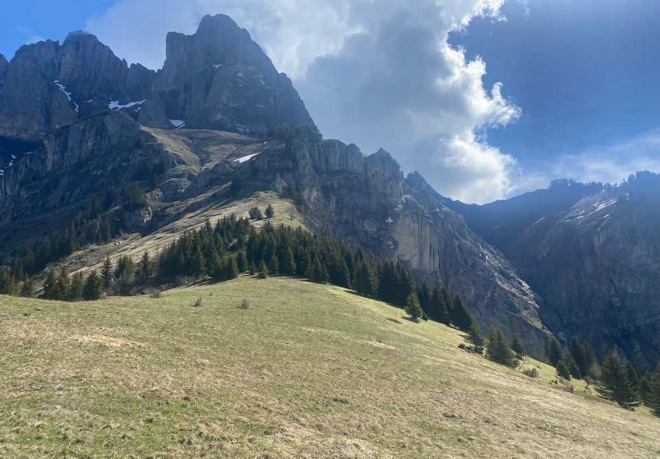
When traveling in and out of Chamonix, you will be struck by the big cliffs of the Pointe de Plate and the Tete du Colonney behind Servoz and Passy. And from the valley floor it looks like there are nice plateaus and rock structures along that entire ridge. Plaine Joux is a great starting point for exploring the eastern side of this area and its a starting point for the Tour des Fiz and many other popular trails. I was curious about the western side of this ridge though and the areas above Passy. So I took this trail to finally see what is up there. It did not disappoint. The plateaus above Passy and St Martin sur Arve are beautiful. They give nice views over the Sallanches valley up to Mont Blanc on one side and over to Megeve and the Chaine des Aravis on the other sides. And the trails on those plateaus also have their own dramatic backdrops with the towering cliffs of the Aiguille de Varan and the Pointe de Barmerousse. If this full loop is too long for you then I would recommend parking your car at Bay and going straight to Chalets de Varan effectively cutting the loop in half. You could then explore the other half of this trail another day. You could also do a similar loop starting from Plaine Joux but that adds quite a bit of distance unless you cut out the western section that takes you to Lachat d'en haut.
UPDATE: Unfortunately it seems that the Refuge de Varan itself has closed. This is according to their facebook page.
Video of this Trail
We have made a video presentation for this trail. The video will provide full 3D fly over of the route and then give a great overview of the experience you can expect when you take on this trail. It is a great way to quickly understand if this is the perfect trail for you. Please visit our channel on YouTube and like the video and subscribe to our channel. Putting together these videos is a lot of work!
Photos of this Trail
Below are all the photos we have in our Chamonix Photos collection for this point of interest. All our photos are tagged with the GPS coordinates and linked to the trails that you can take to find the location where the photo was taken. So if you want to see the full details for a specific photo then just click on it.
Trail Directions & Safety Considerations

Risk Considerations & Difficulty Assessment
This route reaches an altitude of 1680m. It is likely to be snow free from the middle of May to the end of October. You need to check this for the dates you are planning to go. The trail is well marked but definitely not as popular as the main trails inside the Chamonix valley. There are trail markers to guide you to the main navigation points and I had no problem following my chosen route. The trails themselves are not very technical and a large part of it will be on 4x4 tracks used by the farmers around the pastures I am guessing.

Children
15+ Years old

Dogs
We recommend to keep your dog on a leash

Trail Directions
You can take this loop in either direction but my suggestion is to first move north west in the direction of Lachat d'en bas. You need your map and GPS here as there are a couple of roads and trails heading in that direction. The one you want to take takes you from Bay to Hauteville and then there is a 4x4 track thats leads you to Lachat d'en bas on the far end of this trail. This is where you climb up on the GRP Tour du Pays du Mont-Blanc towards Lachat d'en haut. From here you will start your long traverse along the plateau and this is the nicest part of the trail. From Lachat d'en haut you make your way in a south eastern direction and follow signs for Varan. The trail will split in an upper and lower route for meeting the 4x4 track traveling up from Bay to Varan. The higher route is nicer but I could not get my GPS application to accept it so the GPX file on our website takes you on the slightly lower route. You will then zigzag your way up towards Varan. There is a little extra loop that you can add by taking a left turn towards the paragliding launch area above le Pertuis. I did this extra loop but I did not add it to this trail description and GPX file. You will then reach the Chalets de Varan which offer a nice view and its a really nicely perched position. You will then continue on the trail and at the split take your way down the hill to the Chalets de Curalla and down the forest towards the town of Plateau d'Assy. Stay on the higher ground and take the traverse back to Bay and the starting point of this trail.
Points of Interest
Sorry, there are no Points of Interests currently linked to this Trail. Contact us to suggest one.


