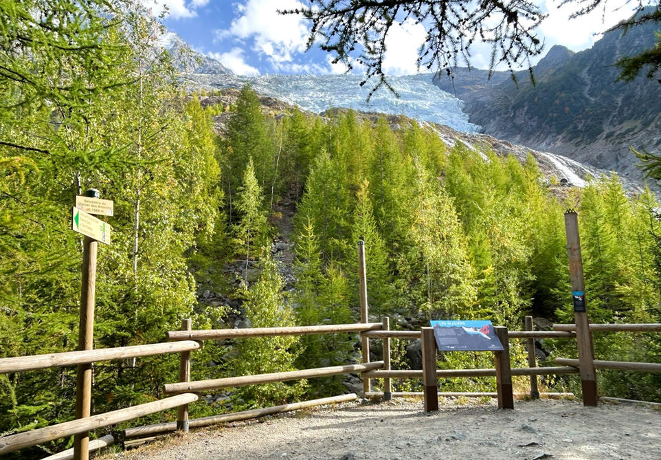
Cascade du Dard and Belvedere des Bossons
Our Rating
6
Above Average
Watch the Full Video on

Length
4.1km

Elevation + / -
337m / 337m

Altitude Range
1234m / 1566m

When to go
End Apr - End Oct
Hike duration
1.5 - 2.5 Hours

Run duration
45 - 75 Mins

Technical level
Moderate

Natural beauty
Nice

Families
7+ Years old

Dogs
Dogs Allowed

Provision Sources
2 Snack Bars

Trail type
Out and Back
This trail visits the very popular Cascade du Dard, the biggest waterfall near the center of Chamonix. The Buvette de la Cascade du Dard is located right next to the waterfall and provides a great location for a meal or a snack. From there we make up our way back to the carpark and start a short climb and cross below the highway leading up to the Mont Blanc Tunnel. We then cross a nice suspension bridge and make our way to the parking for the trail leading to the Buvette du Cero. This little snack bar has a nice deck looking out over the deep gulley that has been cut out by the Glacier des Bossons glacier. From the buvette we take the trail that continues on and passes by 3 viewing points. The first 2 are very close by but don't provide much of a view of the glacier. Reaching the last viewing point at the Belevede du Glacier des Bossons takes a bit longer but has by far the best view. An optional additional short trail leads to the memorial for the 1950 Air India Malabar Princess crash featuring a stone mound with a plaque and a part of the plane.
The trail we present here starts at the parking nearest to the Cascade du Dard. We have a detailed trail description for the route from Chamonix center to the Cascade du Dard and you could combine both trails to start of from Chamonix. Alternate starting points are in Les Bossons and Les Pelerins.
Video of this Trail
We have made a video presentation for this trail. The video will provide full 3D fly over of the route and then give a great overview of the experience you can expect when you take on this trail. It is a great way to quickly understand if this is the perfect trail for you. Please visit our channel on YouTube and like the video and subscribe to our channel. Putting together these videos is a lot of work!
Photos of this Trail
Below are all the photos we have in our Chamonix Photos collection for this point of interest. All our photos are tagged with the GPS coordinates and linked to the trails that you can take to find the location where the photo was taken. So if you want to see the full details for a specific photo then just click on it.
Trail Directions & Safety Considerations

Risk Considerations & Difficulty Assessment
The trail reaches an altitude of 1564 meters and should be snow free from the end of April to the end of October. The trail is very well marked with very few juntions. Navigating the trail will be easy. The path up to the Belvedere is steep but not overly technical. The optional visit to the 1950 airplane crash memorial is unmarked, rocky and more technical.

Children
7+ Years old

Dogs
We recommend to keep your dog on a leash

Trail Starting Point
The trail starts at the Cascade du Dard parking. By car you can reach this parking by taking the highway up to the entrance of the Mont Blanc Tunnel. There will be signs indicating the Cascade du Dard. If you don't have a car available to you, then the easiest option will be to take the trail up to the Cascade du Dard from Chamonix. There are trails leading up to the Cascade from Chamonix-Sud and specifically the big Grepon Parking.

Trail Directions
From the carpark nearest to the Cascade du Dard simply follow the signs for the cascade. You cannot miss it. You will pass by the buvette first and then the waterfall is just little further down. After you are done at the waterfall and buvette make your way back to the parking and look for the trail marker that indicates the Chalet du Cerro. This trail will have you duck below the highway and cross a suspension bridge before arriving at the Cerro parking. From there keep following the signs for the Chalet du Cerro. After the chalet, follow the signs for the "point de vue". Keep following this trail until you reach the Belevedere de Glacier des Bossons. You will notice a path on the right side of the viewing deck that seems to be used quite frequenty. This path, although not marked, can be used to reach the memorial site for the 1950 airplane crash. Once you are done visiting the Belevedere and/or the memorial, simply make you way back down and use the same trail to get back to the Cascade du Dard parking.
Points of Interest
Our hiking and trail running trails around Chamonix are chosen for their natural beauty and variety. We also always try to combine as many sights, attractions and points of interests as possible in our trails. Below you will find a list of the points of interests linked to this trail.


