Length
25.66km

Elevation + / -
1489m / 2067m

Altitude Range
811m / 2509m

When to go
End Jun - Start Oct
Hike duration
7.0 - 11.0 Hours

Run duration
4.0 - 6.0 Hours

Technical level
Moderate

Natural beauty
Incredible

Families
15+ Years old

Dogs
No Dogs

Provision Sources
1 Refuge, 1 Snack Bar

Trail type
Point to point
An amazing route that takes you deep into the nature reserve of Passy and the Vallon de Berard. Almost the entire trail travels within protected natural reserves and as such there are no towns, paved roads or other major infrastructure. It is really great to be in an environment that seems untouched by human hands.
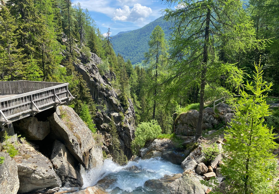
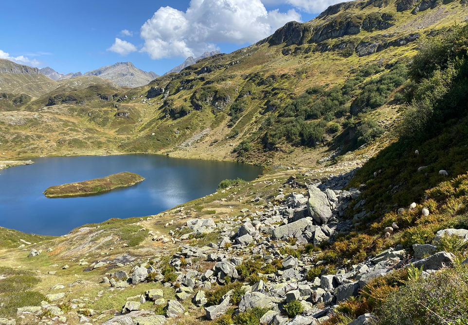
The trail features a great diversity of natural beauty starting with the Cascade de Berard waterfall, incredible meadows, rock formations and the lake of Pormenaz. The trail features two well-known refuges that offer food and accommodation: Refuge de la Pierre Berard and the Refuge Moede Anterne. Make sure to check that these are open in case you will be relying on them for your nutrition.
This trail is easy to do without a car as you can start it at the Buet train station and end it at the Servoz train station and easily get back to any location within the Chamonix valley afterwards.
Video of this Trail
We have made a video presentation for this trail. The video will provide full 3D fly over of the route and then give a great overview of the experience you can expect when you take on this trail. It is a great way to quickly understand if this is the perfect trail for you. Please visit our channel on YouTube and like the video and subscribe to our channel. Putting together these videos is a lot of work!
Photos of this Trail
Below are all the photos we have in our Chamonix Photos collection for this point of interest. All our photos are tagged with the GPS coordinates and linked to the trails that you can take to find the location where the photo was taken. So if you want to see the full details for a specific photo then just click on it.
Trail Directions & Safety Considerations

Risk Considerations & Difficulty Assessment
This route reaches an altitude of 2526m at the Col de Salenton. The climb up to the col and onwards to the Buet summit is a popular ski touring route and there will be snow cover till quite late in the season. As such this trail is recommended from mid-late June to October and you need to check snow conditions ahead of time. The trails are generally well marked. After leaving the Refuge de Berard there are multiple paths that will take you up to the Col de Salenton. The main paths will be marked with pointed dots on the rocks. This part is steep and rocky with some big steps. The descent after Col de Salenton is steep with lose scree but nothing too crazy. I had a bit of a hard time finding the right way towards the Chalets de Villy and there are multiple paths heading in the same direction. Stay on the path that looks the widest and most used. The rest of the Trail is easy to follow and not difficult. If you will be depending on the Refuge Berard and Refuge Moede Anterne for your water and/or food then you need to check ahead of time to make sure they are open during your chosen date. Also be aware that there is very limited cell phone coverage in the valley between Col de Salenton and Refuge Moede Anterne. Personally, I had no cell phone coverage for the vast majority of this section.

Children
15+ Years old

Dogs
Natural Reserve. No dogs allowed.

Trail Directions
From the Le Buet train station and car park, head west and cross the main road and look for signs for Cascade de Berard. There are three main trails that head towards the little hamlet of La Poya and it will not matter much which one you take. At La Poya you will see the trail marker for Cascade de Berard. You cannot miss it. As you approach the waterfall you can stay to the right side to go to the metal platform they have built there to come real close to the waterfall. After doing that, you can take the steep staircase to end up right in front of the Buvette de Berard, a little snack bar beautifully perched above the waterfall. From the Buvette make your way east and follow the signs for Refuge de la Pierre a Berard. This will be your next major destination. Its a single trail that keeps going west and it is well marked. You cannot go wrong here. The refuge sits at the far end of the valley and has nice views and its a great source of water and food and snacks when it's open. From Refuge de Berard you will head out in north western direction past the water fountain and start your climb up to the Col de Salenton. There are a few routes you can take here to make your way up through this rocky section of the trail but they all end up on the same ridge near the Col de Salenton. At this junction you can take a right turn to head towards the summit of Le Buet but you will be taking the left turn and head towards the Col de Salenton. The Col itself has a nice view of the valley ahead and back towards the valley you just came from. From the Col de Salenton you will start descending westwards. Initially the main trail is very clear and you cannot miss it. The two times I visited it, I got a bit confused by the side trails and cattle trails and I ended up getting off the main trail. If you have a GPS app then now would be a good time to use it with the general goal of staying on the main trail and crossing the little streams and getting towards the valley floor and the main route towards your next main destination: the Chalets de Villy. There is a trail that reaches the Refuge de Moede Anterne from a more westward and higher altitude approach but the main trail, that is part of the GRP Tour du Pays du Mont-Blanc, is the trail I suggest you take and that one passes by the Chalet de Villy. You will be able to see the Chalets fairly early on from a distance as you make your way down the valley. The two times I passed by the Chalets de Villy they had a water fountain there. From the Chalets de Villy your next main destination is the Refuge de Moede Anterne. This is a straight trail and it's easy to follow. Refuge Moede Anterne is definitely one of my favorites and after covering the distance between Refuge Berard and this refuge, it is probably welcome place for a break and a snack. From Refuge Moede Anterne head south on the crest trail towards Lac de Pormenaz. You will be visiting the lake and taking the trail on its western edge. From there keep going south towards the Chalets de Pormenaz. There is trail from the lake going westwards in the direction of Les Ayeres and although you can reach Servoz that way too, this particular trail goes over the Pormenaz mountain and through the pastures of the Chalets de Pormenaz. After passing the Chalets you will start your descend of the mountain and pass through forest trails in the direction of Servoz. As you reach the bottom of the steep climb, keep on the right side towards the Tete de la Fontaine and Servoz. If you want to you can visit the Tete de la Fontaine, a nice little snackbar looking out over Servoz. Your destination will be Servoz and there will be signs for Servoz Chef-lieu that you can follow till you reach the little town center of Servoz. From the main roundabout take the roach going to south towards the Servoz Train station. Its a long straight road and there will be signs guiding you to the train station. Once there you can take the train back to Chamonix or wherever you need to go next.
Points of Interest
Our hiking and trail running trails around Chamonix are chosen for their natural beauty and variety. We also always try to combine as many sights, attractions and points of interests as possible in our trails. Below you will find a list of the points of interests linked to this trail.


